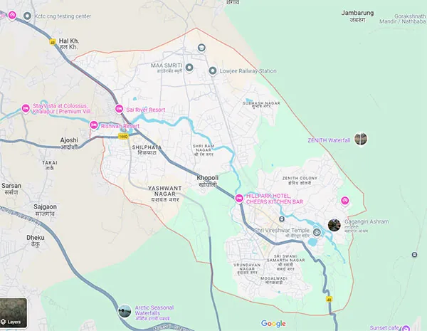
Geography & Climate
Nestled at the foothills of the Sahyadri range, Khopoli lies along the Patalganga River-India's first private hydroelectric tailrace-at an elevation of ~61 m and coordinates 18°47'N 73°20'E. Covering ~30 km², the region features:
Dry winters and intense monsoons from June to September
Rolling hills, verdant valleys, scenic lakes, and forests
Close to Mrugagad Fort & Karnala Bird Sanctuary in Sahyadris
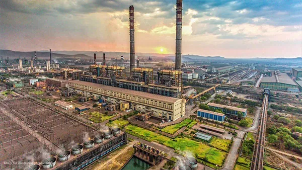
Economic Overview
Khopoli stands out as a key industrial and economic centre thanks to:
Heavy industries:
Steel (JSW), chemicals (Alta Labs, Bombay Oxygen), specialty steel, pharma, engineering, power - centered in Patalganga MIDC & Khopoli Industrial Estate
Hydropower legacy:
The Tata Hydroelectric Station built in 1915, with the Patalganga River still fueling the local power economy
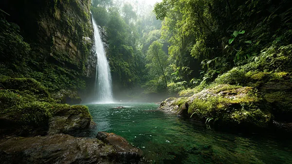
Real Estate & Infrastructure Boom
Khopoli's natural geography is rich and diverse, earning it the nickname "City of Waterfalls" due to its numerous seasonal waterfalls. Key features include:
Expressway “Missing Link”:
95% complete, set to open August 2025—cuts 25-30 min from Mumbai-Pune travel, reshaping Khopoli into a logistics and commuter hub
Price projections:
Land values expected to double or triple over 3-5 years; general 30-50% growth over the next decade
Major developments:
- Luxury plots, villas, premium resorts (Radisson, Novotel Imagicaa)
- Projects like Unimont Imperia and Arvind SmartSpaces' 92-acre township with golf course
Mumbai 3.0 integration:
Karnala-Sai-Chirner (Third Mumbai) mega-city planning spans 324 km², linking Khopoli to future MMR infrastructure

Retail, Services & Tourism Sector
Beyond industry and real estate, Khopoli offers rising employment in:
- Retail and hospitality driven by tourism-Imagicaa Theme Park, water-fall tourism, and wellness resorts
- A growing services sector: health, education, coaching centres, and trading services for the migrant workforce
Strategic Impact & Outlook
| Element | Impact & Insight |
|---|---|
| Connectivity | Expressway upgrade + NAINA + Third Mumbai = Unprecedented accessibility |
| Investment Appeal | IRR potential high; luxury to mass housing demand on the rise |
| Industry & Logistics | MIDC + expressway corridor + rail = prime logistics node |
| Tourism & Retail | Infrastructure enables expansion of leisure, food, and hospitality businesses |
| Long-Term Vision | Strategic MMR node set to integrate industrial, residential & urban-city growth |
